>

Penfield Light:     Fl R 6sec 53ft 20M Horn


When approaching Fairfield from the West, it is very tempting to pass between the lighthouse and the shore.

Don't do this!.

It may look inviting at high tide, but there's a reef stretching all the way from the shore to the light. At low spring tide, you can walk on it, almost two miles offshore! Very few summer days go by without some boater discovering Penfield Reef - the hard way.
It's not a good idea to pass too close to the light, either. There are some major rocks to the east, marked by a white sign (marked as "W Bn" on the chart) known locally as the 'lollipop'. The sign says 'rocks' - take my word for it - so there's no need for you to come too close trying to read it. The sign marks Black Rock.
The rock formation known as the 'Little Cows' (they are not little) is just below the surface, to the east. The Little cows are now protected by a green buoy marked "LC". The buoy may not be on your chart - it was put in within the last couple of years.


Return to the chart


Southport Harbor

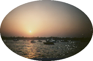
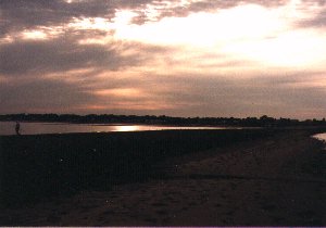
A beautiful, sheltered little harbor - arguably the prettiest in the Sound.
Home of the Pequot Yacht Club and Ye Yacht Yard. Visit at mid tide or higher - the channel is narrow, with shoal water on either side. Keep to the channel, and don't be tempted to cut corners. Be prepared to give way to small sailboats, and keep your speed to a minimum - there isn't much room to manoeuver. All moorings are spoken-for, but visitors from affiliated yacht clubs may be able to arrange something with the Pequot Yacht Club (but don't bet the farm on it).

Return to the chart


Sasco Reef

Every local knows about Penfield Reef (particularly those who have run aground on it), but don't ignore Sasco Reef (locally known as Sunken Island). It may be smaller, but it's just as hard. Visible at spring low tide, and lurking below the surface at any other time, it is protected by red buoy 22 (Fl R 4sec BELL).
Don't even think about a course between the buoy and the coast. You may get lucky, but then again.......

Return to the chart


Penfield Reef

When you approach Fairfield and Black Rock from the West at high tide, there is what looks like a wide open expanse of water, with a lighthouse about two miles offshore. On the other side of this expanse, Black Rock Harbor beckons. Straight through, right?
Wrong!
If you approach at low tide, you'll see a different picture - a reef stretching from Shoal Point almost to the lighthouse. The lighthouse is called Penfield Light. The reef it guards is Penfield Reef.

Don't go between the lighthouse and the land, even if you see someone else do so. Some locals claim to know a safe passage. Most are just lucky. You have been warned.

In summer, groundings on Penfield Reef are almost daily. Don't become a statistic.
Oh, by the way, the picture was taken from the reef, about half way along it, facing the shore.
Convinced now?

Return to the chart


South Benson Marina

At the mouth of Ash Creek is South Benson Marina - Fairfield's town marina. Don't bother looking for transient slips - this marina is for town residents only, and there's a multi-year waiting list. They have a gas dock, though, a place to empty your porta-potti, a pump-out station and somewhere to buy ice, snack food and bait (hopefully in separate bags).
The channel buoys have a tendency to drift off station after bad weather, although they are fine at the moment (July 2007). The channel has rip-rap on the left and shoals on the right. You may want to use the range when entering, if you can see it through the trees; it will bring you right up the center of the channel. Green lights, one flashing, the other quick flashing. Watch out for vicious tide rips at intermediate states of the tide, or if Ash Creek is swollen by heavy rain. Again, dredging has improved matters, but there are still eddies, particularly round the mouth of the marina.
Best visited at or near high tide and definitely in daylight.

CAUTION! Shoaling has been reported in the channel, with a depth of 3 feet at low water. Markers have been posted on shore, marking the danger area. The town has been able to improve the depth on the Fairfield (West) side of the channel. This information is current, as of July 2007.


Return to the chart


Black Rock Harbor

A friendly, busy harbor, catering mainly to the pleasure boater (although you do see the occasional gravel barge). A few years ago, the harbor was grimy and run down, but now it is a pleasant place to moor, and the wildlife is returning (Ospreys diving for fish, even phosphorescence at night).
The channel is wide, deep and easy to follow. Look out for the disused lighthouse on the east side of the harbor entrance. It isn't a functioning aid to navigation, but it makes the harbor entrance easy to spot.
Black Rock Yacht Club, first on the left as you enter, may have transient moorings for members of affiliated clubs. Fayerweather Yacht Club, about halfway in, at the narrowest point in the channel, may also have transient moorings, and definitely do have a gas dock. Captain's Cove Marina is at the head of the harbor. They are a full-service marina. The only downside of Black Rock is its wide-open South Westerly aspect. When the South West wind rises over 10 knots, prepare for a bumpy ride (or take a slip at Captain's Cove).

Return to the chart


Captain's Cove

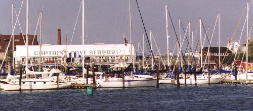
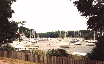
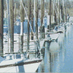
The area's major commercial marina.
Plenty of slips, a good seafood restaurant, a gas dock and a free pump out station. Full repair and haul-out facilities.
They have a web site.
At weekends, they have live entertainment and dancing. The boardwalk features gift shops with a nautical flavor - something for all the family.
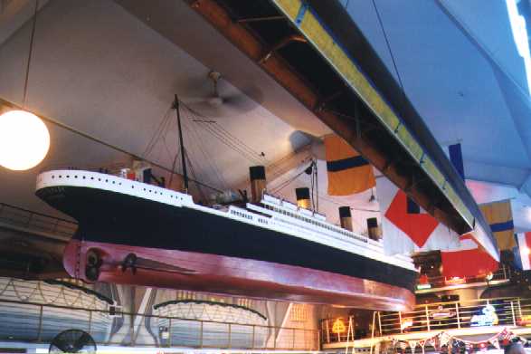
The bar contains this forty foot model of the Titanic, hanging from the ceiling, and the bar itself is built around the wheelhouse of a tugboat
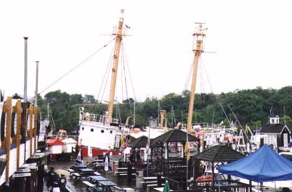
And speaking of Titanic, a few years ago, the current attraction was the Nantucket Lightship. The predecessor of this craft was rammed and sunk by Olympic, Titanic's sister ship. Unfortunately, this attraction has gone elsewhere.
Here's what she used to look like from the water.
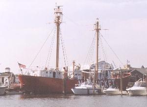
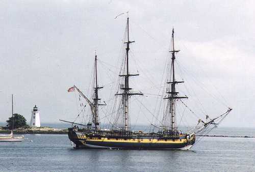
And if you're lucky, you'll see HMS Rose visit her home port of Black Rock.
She's been sold to a film company, but hopefully she'll return to her home once in a while. For more information about her, try the HMS Rose Official Home Page


Return to the chart


Fairfield Beach

Not a bad place to drop a hook for lunch. Good holding on a sandy bottom. Best to keep some distance from the beach, to avoid the wakes of the waterskiers and the noise from personal water craft.
An excellent place from which to view Fairfield's firework display on July 4th (let off from a barge moored off the beach), provided you don't mind mixing with a fleet who boat at night only once a year.

Return to the chart


      Urquhart Home Page                    Penfield Power Squadron